About The WaterShed
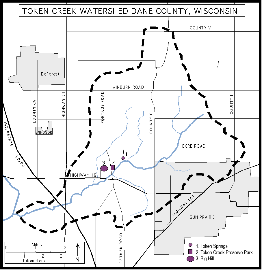
The watershed comprises a 27 square mile area of Dane County, Wisconsin landscape whose waters drain into Token Creek. The watershed basin lies between Sun Prairie and DeForest and drains snowmelt and rainfall into Cherokee Marsh and eventually Lake Mendota. Although situated just north of the most rapidly growing metropolitan area in Wisconsin, The watershed is still dominated by the rolling green hills of local farms and flows into the largest wetland in Dane County, Cherokee Marsh. Token Creek itself originates from some of the most productive springs in Southern Wisconsin and provides more base flow to Lake Mendota than any of the lake’s other tributaries.

Token Creek conservancy Trail Map
A key component of the Token Creek Watershed is the 190 acre Token Creek Conservancy where visitors can enjoy hiking, fishing, and the headwaters springs.
The Trail Map can be downloaded and printed.

About us
The Friends of the Token Creek Watershed is a citizen-based
non-profit organization dedicated to preserving the natural beauty and environmental health of Token Creek. The Friends actively engage in conservation efforts within the watershed through workdays, fundraising, and the protection of environmentally sensitive land. Past initiatives involved restoring the creek’s natural flow, improving accessibility in the Token Creek Conservancy, and aquiring wetlands within the watershed for preservation and low-impact public use. The group also supports, and plans to expand, an award-winning water quality testing program.

About The WaterShed
Have any questions? Want to get involved? Have ideas for projects to protect or improve resources within the watershed? Let’s talk…
